Title search results
Showing 1 - 2 of 2 items

Braille (Contracted), Electronic braille (Contracted), DAISY audio (Direct to player), DAISY audio (Zip)
Award winning fictionAward winning non-fiction, Canadian non-fiction, Canadian history, Canadian travel and geography
Human-narrated audio, Automated braille
12-year-old Guy keeps a journal as he tours Canada with his parents and younger sister, Rachel. Learn about each province…
and territory, with information about major cities along the way, and other fun Canadian facts in sections like "According to Mom/Dad", "Exceedingly Weird", and "Food I Was Introduced to for My Own Good". Also included is "Guy's Family Car Trip Survival Tips". Grades 3-6. 1999.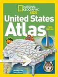
Braille (Contracted), Electronic braille (Contracted), DAISY Audio (Direct to Player), DAISY Audio (Zip), DAISY text (Direct to player), DAISY text (Zip), Word (Zip), ePub (Zip)
United States travel and geography
Synthetic audio, Automated braille
Kids will have fun learning about every U.S. state in this amazing atlas, packed with maps, stats, facts, and pictures.…
National Geographic's world-renowned cartographers have paired up with education experts to create maps of the 50 states, U.S. territories, and Washington, D.C., that pinpoint the physical features, capitals, and towns and cities of each state. Discover the latest data and trends along with colourful photography of each state and the people who live there. Key points reflect the latest information about land and water, people, and places. Lively essays cover each region of the country. Eight specially themed maps on nature, population, energy, climate, and more, delve deeper into key issues. State birds and state flags add to the high visual interest. This is a great reference for home and school with all the basics kids need to know to succeed in middle school, high school, and beyond.